Geomatics (GM)
Email: eduard.angelats@cttc.catPhone: +34 93 645 29 00
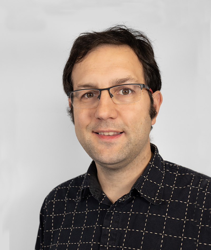
Eduard Angelats holds a M.Sc. in Telecommunications Engineering from Technical University of Catalonia (UPC) in 2008, where he currently is an Aerospace Science and Technology PhD student. He has a previous research background in image processing from his experience at the Institute of Imaging and Computer Vision (RWTH Aachen University, Germany). In 2009, he joined as a research assistant the former Institute of Geomatics, where he was involved in the development of innovative trajectory determination systems based on robust and hybrid navigation and focused on alternative applications. Since January 2014 is with CTTC, where he is a researcher of the GEON department as part of the Geomatics division.
His research is related to the development and implementation of algorithms for multi sensor based positioning in GNSS unfriendly environments, and algorithms for the fusion of camera and LiDAR data, for both RPAS and mobile mapping platforms. This line is directly related with the department research lines, in which he actively contributed to their definition. In the last years, he has also started to investigate the potential of using multispectral imagery, from RPAS or Sentinel-2, together with advanced processing techniques for the detection of archaeological non-superficial remains and for water quality control for aquaculture applications. This line is also fully related to new platforms and paradigms of high-resolution geodata acquisition, one of the research lines of the GEON department.
He has been involved in several European projects, funded by grants from the European Commission (such as the Seventh Framework or H2020 programmes): IOPES, ATENEA, GINSEC, ENCORE, CLOSE-SEARCH; Nationally funded grants: ARCHREMOTLANDS, ATENEA+, GeoTRAM, DECIVEL; and Industrial projects: CATERPILLAR, PERIGEO, ASRAIM. He is also actively involved in the maintenance, improvement and finding new applications or uses of the GEMMA testbed. Since 2015, he has participated in the preparation of 25 European, National and Industrial proposals, being in 7 the CTTC promoter and in 3 of them the proposal promoter. He has participated in the organization of several specialized courses as well as the IOPES users’ meeting in 2020. He also has been invited as lecturer in other specialized courses.
He is co-author of 1 journal papers and 25 conference papers, and he has supervised and co-supervised 3 TFG thesis and 2 TFM theses. He is also a lecturer of Master’s degree in Applications and Technologies for Unmanned Aircraft Systems (UPC) and invited lecturer of master’s degree in Advanced Studies in Archaeology (UB). Finally, he is part of the scientific team of the Roman and Late antique city of Pollentia (Mallorca, Spain).
ORCID ID: https://orcid.org/0000-0001-7321-4825
MISCELLANEOUS
|
Scientific papers |
1 journal, 25 international conferences | |
|
Citations |
38 citations / h-index=4 (Scopus). | |
|
Participation in testbeds |
Involved in testbed GEMMA NAVIGATION | |
|
Participation in research projects |
13: 5 international, 5 national, 3 industrial. | |
|
Project participation roles |
IOPES (Technical manager), GINSEC (participant), ATENEA (participant), CLOSE-SEARCH (participant), ENCORE (participant), ARCHREMOTELANDS (WP leader), ATENEA+ (WP leader), GeoTRAM (Technical manager), DECIVEL (participant), Pollentia (Consell Mallorca) (Principal investigator), CATERPILLAR (Technical Manager), PERIGEO (WP leader and Technical Manager), ASRAIM (participant). | |
|
|
||
|
Participation in proposals preparation |
Involved in 25 European, National and Industrial proposals (H2020, DG-ECHO, NATO SPS, ATTRACT, MINECO, Fundación Biodiversidad, Recercaixa, Fundación BBVA), 7 of them as CTTC promoter and 3 of them as proposal promoter. | |
|
|
||
|
Invited Talks |
Invited talk on “Localization Technologies” (02/06/2017) in the frame of “Intelligent Vehicle and Business opportunities, Technologies, challenges and opportunities for a sustainable mobility“ course, organized by Parc Recerca UAB and Centre Visió Computador. | |
|
|
||
|
Contribution to Conferences |
25 contributions to conferences (20 oral and 5 poster). | |
|
Internal Dissemination |
4 internal seminars during last year. | |
|
Professional Service |
Reviewer of International Journal of Photogrammetry and Remote Sensing, Journal of Remote Rensing, Journal of Cultural Heritage, Journal of Agronomy, IEEE Transactions on Vehicular Technology. | |
|
|
||
|
Awards |
Best paper award of 2018 IEEE International Conference on Metrology for Archaeology and Cultural Heritage, 22–24 October 2018, Cassino (Italy), for the paper “High resolution orthophotos and a digital surface model of the Roman city of Pollentia (Mallorca, Spain) using RPAS imagery, aerial images, and open data archives”. | |
|
|
||
|
Teaching activity |
Lecturer of master’s degree in Applications and Technologies for Unmanned Aircraft Systems (UPC) and invited lecturer of master’s degree in Advanced Studies in Archaeology. | |
|
|
||
|
Academic supervision |
5, 3 supervised master theses and 2 bachelor theses | |
|
Training |
1-year stage at the Institute of Imaging and Computer Vision (RWTH Aachen University, Germany), 2007 |
