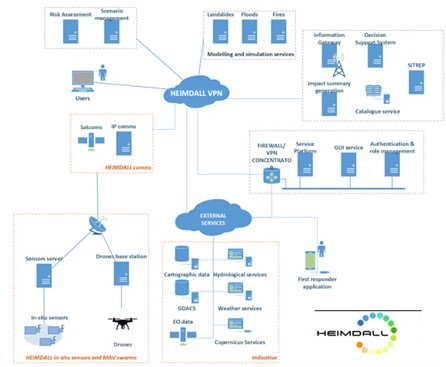
On Thursday, January, 21 2021 a practical exercise simulating a multi-risk emergency has been be carried out as closing Event of the European Project HEIMDALL to demonstrate the functionalities of the platform developed in the project’s framework. The platform aims to help the operatives to make efficient, well-informed and safe decisions. End users and consortium partners met in a hybrid virtual and in-person event, participating in an international practical exercise as a final result of the HEIMDALL project framed in the HORIZON 2020 program ( https://www.youtube.com/watch?v=JIhmhxZHhj8&feature=youtu.be ). Geomatics division of CTTC provided final products obtained processing SAR Interferometric data from ESA Sentinel-1 satellite images, and deformation maps obtained from GB SAR experimental campaigns aimed at landslides monitoring.

